


Voting District 0050128000002, Allegan County, Michigan
About
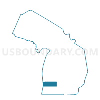
Outline

Summary
| Unique Area Identifier | 595797 |
| Name | Voting District 0050128000002 |
| County | Allegan County |
| State | Michigan |
| Area (square miles) | 13.47 |
| Land Area (square miles) | 12.95 |
| Water Area (square miles) | 0.52 |
| % of Land Area | 96.14 |
| % of Water Area | 3.86 |
| Latitude of the Internal Point | 42.54412120 |
| Longtitude of the Internal Point | -85.79886300 |
Maps


Graphs
Select a template below for downloading or customizing gragh for Voting District 0050128000002, Allegan County, Michigan


Neighbors
Neighoring Voting District (by Name) Neighboring Voting District on the Map
- Voting District 0050126000001, Allegan County, MI
- Voting District 0050128000001, Allegan County, MI
- Voting District 0053920000001A, Allegan County, MI
- Voting District 0055520000001, Allegan County, MI
- Voting District 0056164000001, Allegan County, MI
- Voting District 0058062000001, Allegan County, MI
- Voting District 0058458000001A, Allegan County, MI
- Voting District 0058458000001B, Allegan County, MI
Top 10 Neighboring County Subdivision (by Population) Neighboring County Subdivision on the Map
- Otsego township, Allegan County, MI (5,594)
- Allegan city, Allegan County, MI (4,998)
- Allegan township, Allegan County, MI (4,406)
- Hopkins township, Allegan County, MI (2,601)
- Trowbridge township, Allegan County, MI (2,502)
- Monterey township, Allegan County, MI (2,356)
- Watson township, Allegan County, MI (2,063)
Top 10 Neighboring Place (by Population) Neighboring Place on the Map
Top 10 Neighboring Unified School District (by Population) Neighboring Unified School District on the Map
Top 10 Neighboring State Legislative District Lower Chamber (by Population) Neighboring State Legislative District Lower Chamber on the Map
Top 10 Neighboring State Legislative District Upper Chamber (by Population) Neighboring State Legislative District Upper Chamber on the Map
Top 10 Neighboring 111th Congressional District (by Population) Neighboring 111th Congressional District on the Map
Top 10 Neighboring Census Tract (by Population) Neighboring Census Tract on the Map
- Census Tract 311, Allegan County, MI (6,409)
- Census Tract 312, Allegan County, MI (5,497)
- Census Tract 306, Allegan County, MI (4,957)
- Census Tract 313, Allegan County, MI (4,692)
- Census Tract 318, Allegan County, MI (4,486)